| Author | Message | ||
Hootowl |
Hope our brethren in the UK are OK. Looks pretty bad. https://www.google.com/#q=river+thames+flood&tbm=n ws | ||
Rocket_in_uk |
It's a huge area when considering it's much of Somerset, Sussex, Dorset, and a lot of other areas all under water at the same time. Some have been flooded since Christmas week. Thank you for saying so. Rocket in England | ||
Rocket_in_uk |
Turns out things are a lot worse than I thought . . . . . . . . . . . . . . . . . . . . . . . . . . . . . . . . . . . . . . . . . . . . . . . . . ROYAL FLUSH 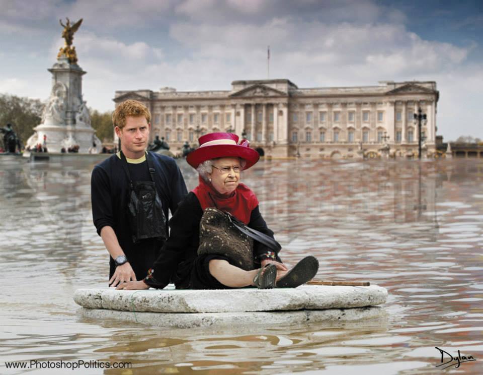 Rocket in England | ||
46champ |
What! you are allowed to use the royal family in any kind of humorous setting I am shocked. You need to give the ausies their water back. | ||
Fahren |
 | ||
Trojan |
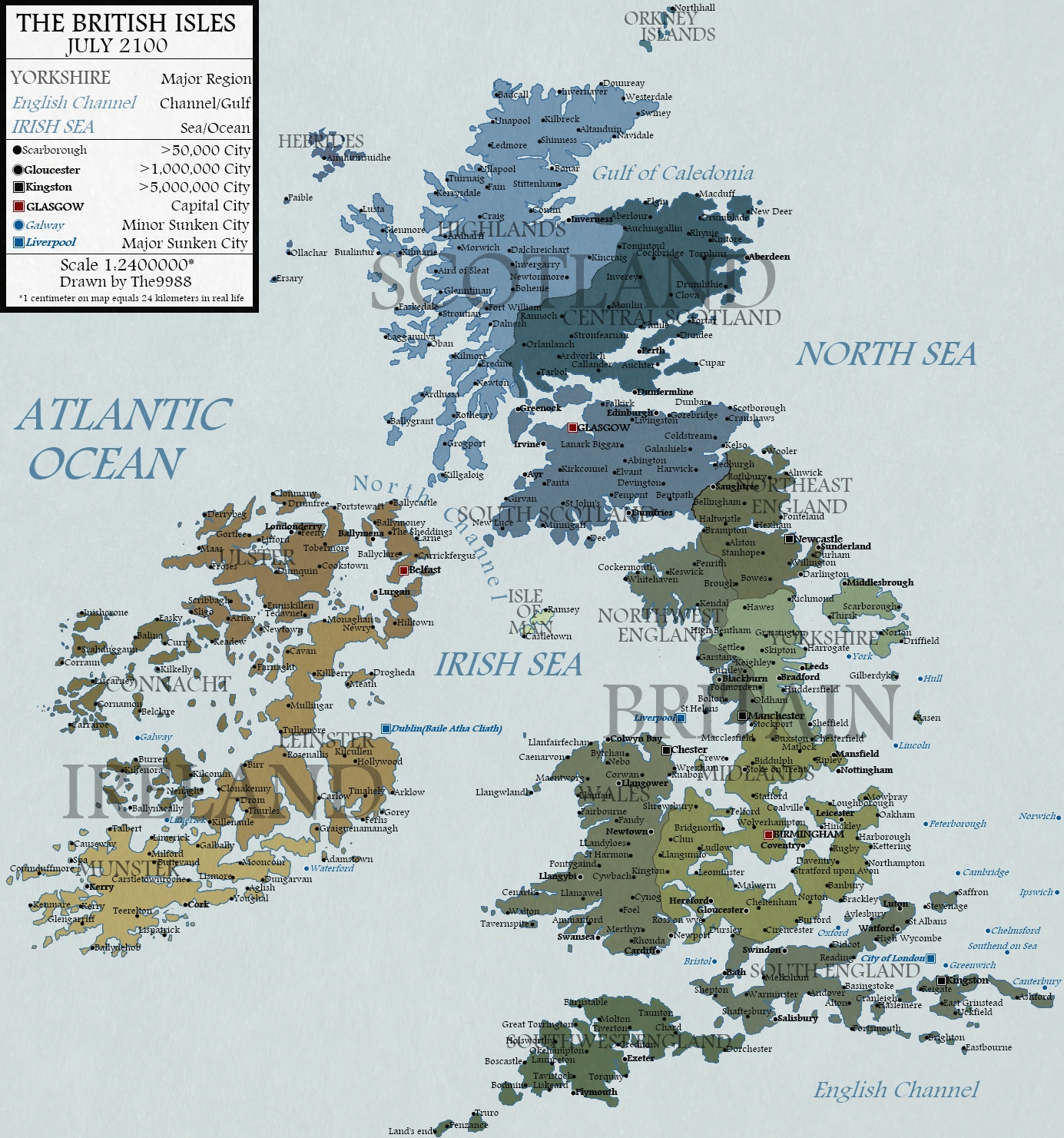
Lets look on the bright side. If I stay in my house then I'll live at the seaside soon, so it will save me a 20 minute drive to walk the dogs on the beach  I'm pretty sure that the map will need updating because Scotland is planning to float away somewhere near iceland next year  Also I think the Scottish parliament in Edinburgh may be upset to see that Gloasgow is now the Scottish capital! Also I think the Scottish parliament in Edinburgh may be upset to see that Gloasgow is now the Scottish capital! US service personnel based in East Anglia may want to buy some waders pretty soon though  | ||
Rocket_in_uk |
Look on the bright side. Rocket drowned! Rocket in England | ||
Aesquire |
Hang in there. Prayers are with you folk. I thought it was mandatory to make fun of the Royals? BTW, one of my favorite films is "King Ralph". Peter O'Toole & Richard Griffiths were both brilliant. Not that I wish any harm upon the Royal family, but I loved the way it depicted the reactions of the English people to their new King. I can't imagine Price Charles throwing spears at a target. Andrew, sure. but I digress. Good luck. Want us to send you our cold? You could skate across Sussex. That'd be a picture. | ||
Rocket_in_uk |
I'm in the north east. Hull on the above map - and we've had a tad of flooding a week before Christmas was all. A flood wall breached and a few businesses got flooded in an industrial area. A few residencies up river were flooded too, but absolutely nothing like what the south west has suffered. That said we had some 100mph winds here yesterday. Lots of trees down. Vehicles overturned etc. The Humber Bridge was closed for only its second time in 30 years or so. 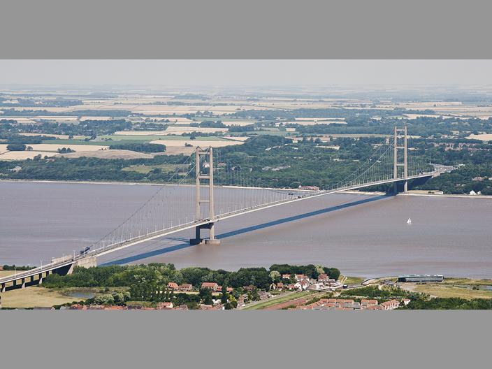 Rocket in England | ||
Aesquire |
I'd never seen that angle on the Humber Bridge. I am so impressed by the one pair of caissons. I mean, I know the numbers, but seeing that singular leap just hammers home how long it is. I must ride a bicycle across that. ( longest span in the world when built, #7 today, still longest bridge in the World you can ride a bike or walk across. Dang. ) | ||
Trojan |
We have actually been relatively lucky here in the UK. Areas flooded are on traditional flood plains mostly and there has been surprisingly little injury or loss of life to people. In Europe there is just as much damage and destruction to Spain, Portugal and France but we just don't get to hear about it on our news. http://www.euronews.com/2014/02/06/more-bad-weathe r-forecast-as-western-europe-coastlines-assess-sto rm-damage The USA is actually faring much worse (what we are experiencing is the tail end of the US weather pattern) and with 350,000 without power in the southern states around North Carolina and an expected 1ft of snow coming I would rather be here in the UK than in most other places thanks | ||
Rocket_in_uk |
The bridge is seen from the south bank. The North Sea is about 20 miles to the right (east) In the foreground you can see the outskirts of Barton. A small market town, not far from the first US Airbase established here in the UK at Goxhill, which in itself has a fascinating story / history. http://www.bcar.org.uk/goxhill-history.php The long building bottom right is an art centre and nature reserve built on old chemical works. The centre pays tribute to John Harrison, the inventor of the marine chronograph. Thus the man credited with solving the problem of finding longitude. As a young child the family had moved to Barrow on Humber, just a few miles down river. http://en.wikipedia.org/wiki/John_Harrison The Humber Bridge south bank viewing area is hidden from view in the trees. On the north bank (the cottage where I live is about 4 miles due north of the tower) you can see a building which is visible in the centre of the bridge span. This is a good pub in a secluded location with great views - obviously! The one night floods we had Christmas week, I mentioned previously also, this pub and the cottages and dwellings to the right of the north bank tower, all were flooded pretty bad. This area is known as Hessle Foreshore and is a popular viewing area. You can only make out the last few cottages in the pic but there's a row of them about 1/4 mile long where the river front properties enjoy great views of the bridge and the Humber itself. Looking at where the north bank tower is stood there have been a number of significant historical finds around and about these shores. A couple of miles up river at Ferriby, the oldest known seaworthy boats in northern Europe were discovered. http://www.nytimes.com/2001/06/10/world/edward-wright-who-unearthed-ancient-boats-on-england-s-coast-dies-at-82.html A few years ago a local man walking his dog pulled up a piece of old timber. Turned out to be a 3000 year old oar. A very old sword was also found here some years ago (can't find the link) which was subject to a court battle, its finders claiming its value dependent on where EXACTLY the sword was found. Only a few feet either side of some boundary meant the difference between treasure trove or not. I forget who won. Useless of me I know. Especially since the sword was worth an absolute fortune. You can't see it in the pic but running along the shore of the north bank is the main road and main rail line into the city of Hull. Both pass under the bridge only a few feet from the north bank tower legs, offering an amazing view. 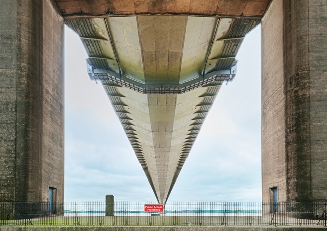 It is also one of the best few miles of riding / driving into any city anywhere. At speed it's exhilarating and rewarding. The road climbs steady uphill about six miles from town. Rising maybe 100 ft above sea level for a mile or so, it crests the brow to reveal the only north bank view from a westerly direction of the entire expanse of the Humber Bridge. If you've not traveled this road before, the sight of the bridge must blow your socks off. It still does mine. Better still, you get to chase the view along a very fast steady downhill two lane carriageway which enjoys two amazing very fast left right curves, the second of which straightens under the bridge. From the bridge it's an almost straight 3 mile run into town, the road running close to the river bank. Late night, early hours, clear road, 150mph and more is easily achievable. Incidentally, the same 6 miles westerly is dull in comparison. Commander Chris Hadfield's pic taken from ISS last year. 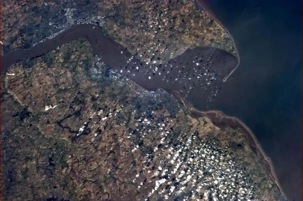 Rocket in England | ||
Rocket_in_uk |
Lots of flood pics here. Some quite spectacular (save the suffering and devastation of course). http://www.dailymail.co.uk/news/article-2555658/UK -weather-16-areas-South-warned-flooding-danger-liv es-Armed-Forces-battle-save-homes.html Rocket in England |